Iceland Volcano: Eruption Has Started Between Mt. Hagafell And Mt. Stóra Skógfell -- Iceland Met Office
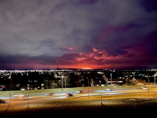 The eruption seen from the balcony of the National Weather Service on Bústaðaveg
This is the fourth eruption on the Sundhnúksgíga crater row
Information is updated regularly here and on X Formerly known as Twitter).
Updated 16. March at 23:50 UTC
A volcanic eruption has begun between Mt. Hagafell and Mt. Stóra Skógfell. The eruption began at 20:23 UTC on 16 March, with a 2.9-km-long fissure forming quickly. The length and location of the fissure is similar to the eruption on 8 February 2024.
The pre-eruptive warning phase was very short. The first warning to the Department of Civil Protection and Emergency Management was at 19:43 UTC, and the onset of eruption was confirmed on web cameras just 40 minutes later. The eruption is effusive in nature, so the eruption plume consists mainly of steam and gas.
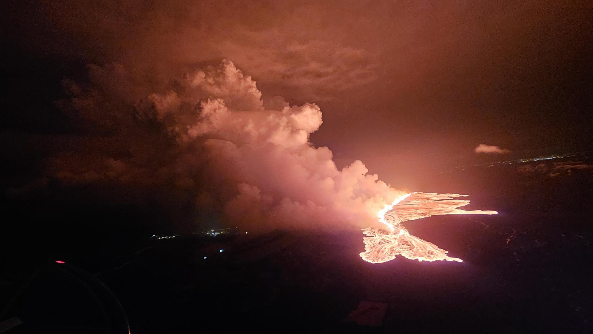 Picture showing the status of the eruption at 21:40. (Photo: DCPEM/Björn Oddsson)
The Icelandic Coast Guard performed a helicopter flight over the eruption area. The flight had experts from IMO, the University of Iceland, the Department of Civil Protection and Emergency Management. Lava is flowing westwards from the eruption fissure in the direction of Grindavíkurvegur (road) and the protection barriers for the Svartsengi region. Additionally, a large lobe of lava is flowing southeast, toward the protection barriers for Grindavík.
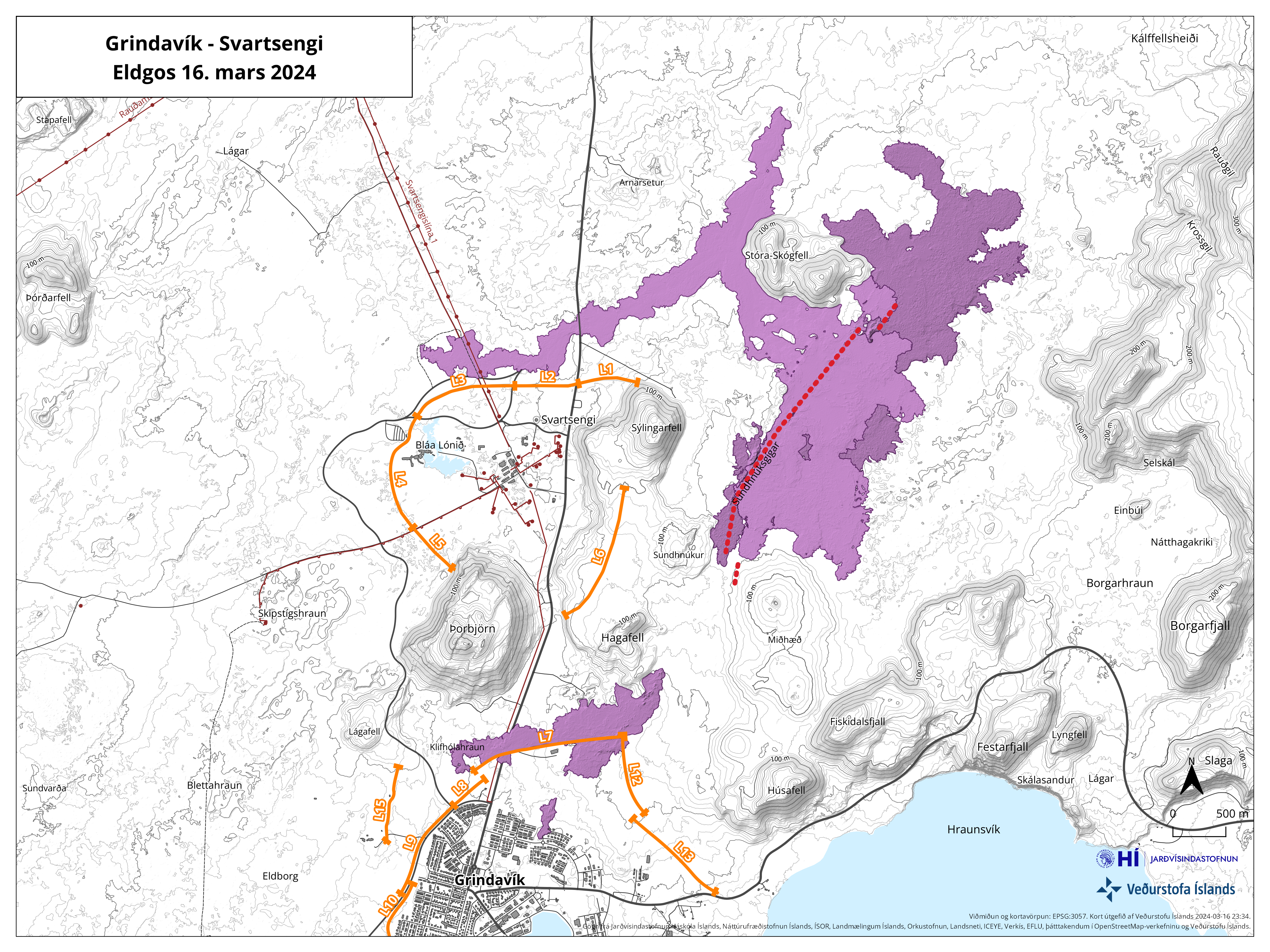 The map shows the fissure opening in red. Orange lines show lava barriers.
From initial assessments of web camera imagery and aerial photographs from the helicopter flight, the eruption is thought to be the largest (in terms of magma discharge) of the three previous fissure eruptions from the Sundhnúkur crater row. This estimate applies to the first hour of eruptive activity.
At 22:10 UTC, the southern lava front was just 200 m from the barriers on the eastern side of Grindavík and moving at a rate of about 1 km per hour. At 22:20 UTC, lava was 700 to 800 m away from Grindavíkurvegur, northwest of Grindavík, moving at a rate of approximately 1 km in 1.5 hours.
- CategoriesEdited | All Content | Disasters | Earthquakes | Volcanos | Government | Science | Europe | Atlantic Ocean | News | News -- WNT Selected
- Date rangeSaturday, March 16, 2024
- Last modifiedSunday, March 17, 2024
